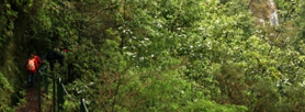
PR 1.1 Ilha Footpath

Start: Pico Ruivo
Finish: freguesia da Ilha ou Achada do Marques
Time: 3h
Distance: 8,2 km
This trail incorporates a drop of 1376 metres, and the climb up or down should be done slowly, taking in the landscape.
Starting at the Pico Ruivo government house, and after climbing up to the mountain’s highest peak, following PR 1.2, it goes down to the Ilha parish. At the hamlet of Vale da Lapa you will walk over the Vale da Lapa tunnel where the trail meets PR9 - Levada do Caldeirão Verde, which begins and ends at Queimadas Forest Park.
The trail crosses through two types of eco-system that are part of the network of important community sites - Natura 2000: the central mountain massif and the Laurisilva forest. The former, from the highest peaks to 1200m, is characterised by herbaceous and bush vegetation that is well-adapted to big temperature variations, heavy rains and strong winds. Here you can see heather plants (Erica scoparia) that are hundreds of years old. Many years ago heather was used for the production of charcoal. As the altitude lessens the indigenous Madeiran forest appears- The Laurisilva Forest, located in the fog area, between 1200 and 400 metres above sea level. This forest is especially important as a “water producer”, as it condenses the water in the mists on its leaves and takes out large quantities of water, sending it into the ground from where if fills the springs and streams.
You may also see the Bisbis (Regulus Ignicapus madeirensis), the smallest of the birds that inhabit Madeira, as well as the curious Chaffinch (Fringila coelebs) which happily approaches hikers. If you are careful you may spot the Trocaz Pigeon (Columba trocaz trocaz), flying across the deepest valleys, where the Laurisilva forest is at its thickest.
The hamlet of Ilha became a parish through a decree of the Regional Government in 1989, and it is part of the Santana Municipal area. It covers an area of 1500 hectares, bordered by the parishes of S. Jorge and Santana and the line between the municipal areas of Câmara de Lobos and Santana, which lies at the top of the Pico Ruivo mountain.
As it was the south side of Madeira Island which was first colonised, a lot of land was distributed to colonists on the North side. This practice explains the original name of Ilha which was Jorge Pinto, the name of the man who set up a majorat there in 1556, covering a small area of Santana and another larger area In S. Jorge, which became known as “island majorat” (morgadio da Ilha). The local economy is based upon agriculture and its principal social characteristic has been that of a Jorge amount of emigration, which continues to be felt there to this day. Following the asphalt road stop by Achada do Marques, a small hamlet known for its typical “poios” (agricultural fields) and old straw lofts.
Pico Ruivo
